Monkmoor Community Woodland
Monkmoor Community Woodland and Belvidere Paddocks is one of the Countryside Team’s larger sites at 5.16Ha. The Severn Way, a long distance footpath travels through the site before heading into the town centre upstream or towards Attingham Park downstream. The Severn Way starts at the source of the River Severn high on Plynlimon, in the uplands of mid Wales and ends in Bristol, a walk of 224 miles! Severn Way – Wikipedia
Habitat
The Community Woodland was created with native, mostly deciduous broadleaved trees in the 1990s using a Forestry Commission grant and was planted by volunteers. It is surrounded by grassland meadow which is managed to keep the area open and free from trees. This maximises the mosaic of habitats and allows a natural woodland edge, one of the most diverse habitat types in the UK. Part of the meadow is sown with annual wildflowers, these give a great visual display but also provide food for various bees and other invertebrates.
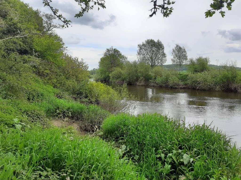
The narrow corridor alongside the river has some very important riparian habitat. Management here is limited except for path and tree safety work. Trees that fall are left in place where possible providing great deadwood habitat.
There are some good size trees along the river walk and a nice section of woodland just before you reach the railway bridge at the end of the site. Unfortunately many of these are ash trees which have an uncertain future due to ash dieback.
Wildlife
There are many species records for this site, mostly invertebrates, including the lesser stag beetle. There are also records for pipistrelle bats. The river is full of fish, waterfowl and otters have been spotted along the stretch.
How to get there
The site can be accessed from numerous points: Manor Road, Hillside Drive, Coseley Avenue or from either direction along the Severn way.
Access
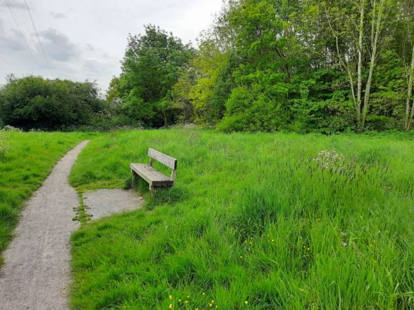
There is an easy access path around the northern block of the woodland. The paths around the rest of the woodland site are crushed stone and are easy to navigate year round. These were installed in 2020 as part of the Town Council’s footpath improvement project.
The walk alongside the river is narrow and seasonally wet, it can be impassable at times of flood. There is a new path leading up from the river to Hillside Drive also created during the path project.
Car parking
The site is only accessible on foot so please be courteous to local residents if parking on the nearby roads.
Grid reference
The grid reference for the centre of the site is SJ 518 131
Postcode
The post code for:
Manor Way SY2 5LN,
St James Road SY2 5YH,
Hillside Drive SY2 5LW,
Coseley Avenue SY2 5UP.